Mobile Mapping / Asset Management
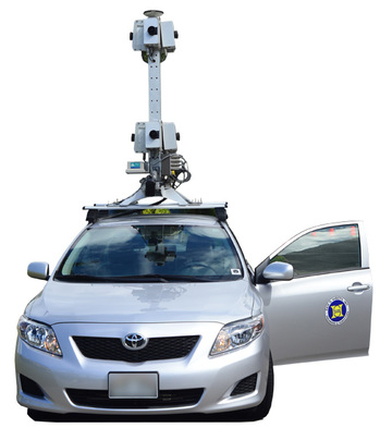
Sam O. Hirota, Inc. vehicle outfitted with earthmine/Nokia MARS system camera/GPS/IMU array.
|
As an official partner of earthmine/Nokia, and owner of one of only two earthmine cars in the United States, Sam O. Hirota, Inc. has select access to one of the best three-dimensional, street-level imaging systems in the world. Able to collect panoramic high-dynamic range photographs at posted speed limits, the resulting high-resolution images yield precise x, y, z coordinates for every pixel.
The City and County of Honolulu recently learned the value of this data after contracting SOH to collect imaging for 3600 lane miles of city streets. Initially earmarked for pavement analysis by the Department of Facilities Management, other city departments have since taken notice of the data and its incredibly clear and comprehensive views of Honolulu. Highly customizable, data can be mapped as well as visualized, measured, and virtually augmented giving unprecedented options for a wide range of applications:
|
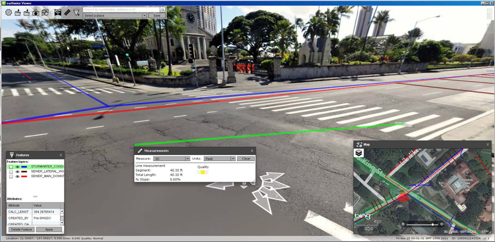
earthmine images can be precisely measured, mapped, and, combined with other layers, used to identify infrastructure assets.