
Boundary Studies and Surveys for Various Army Installations on Oahu, and Island of Hawaii
U.S. Army Garrison-Hawaii (USAG-HI) traces its history to the District of Hawaii, a command formed in 1910 as a sub-element of the Department of California. Today, USAG-HI maintains services, installation facilities, training and recreational centers to nearly 90,000 Soldiers, civilians and family members stationed on the islands of Oahu and Hawaii. USAG-HI is headquartered at Wheeler Army Airfield, just 20 miles from the state capital of Honolulu.
|

|
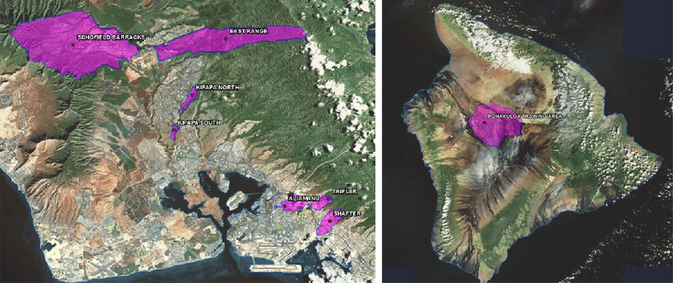
Sam O. Hirota, Inc.Boundary surveys were conducted for various Army installations on the islands of O'ahu and Hawai'i. Surveys included title reports, recovery of boundary evidence, staking of missing boundary corners, location of installation perimeter fence, and location of improvements 5 feet beyond the property boundary. Cadastral survey grade ArcGIS geodatabase development including collection of hard copies, validation of existing survey and title information and creation of parcel /boundary data and monumentation. Surveys also included the installation and location of picture points for reference by the aerial survey. Project deliverables include ArcGIS Geodatabase and metadata for boundaries, survey controls, and monumentation.
Total area for 8 US Army Facilities = 120,974 acres. Photo Science Photo Science was responsible for planning the aerial photography and ground control layouts, as well as collecting the aerial photography and mapping from it. Primary end products included planimetric / topographic mapping in CAD format and color orthophoto imagery. |